
E-TEST Geology
All the data (raw and processed) and all the reports are available through orbi.uliege.be at the following link:
To access the database and the reports, please contact by email the following address:
and specify in the subject : [Access to E-TEST] [reports] or [Access to E-TEST] [D.TX.X.X] and a BELNET link will be send by reply to download the content of the corresponding folders.
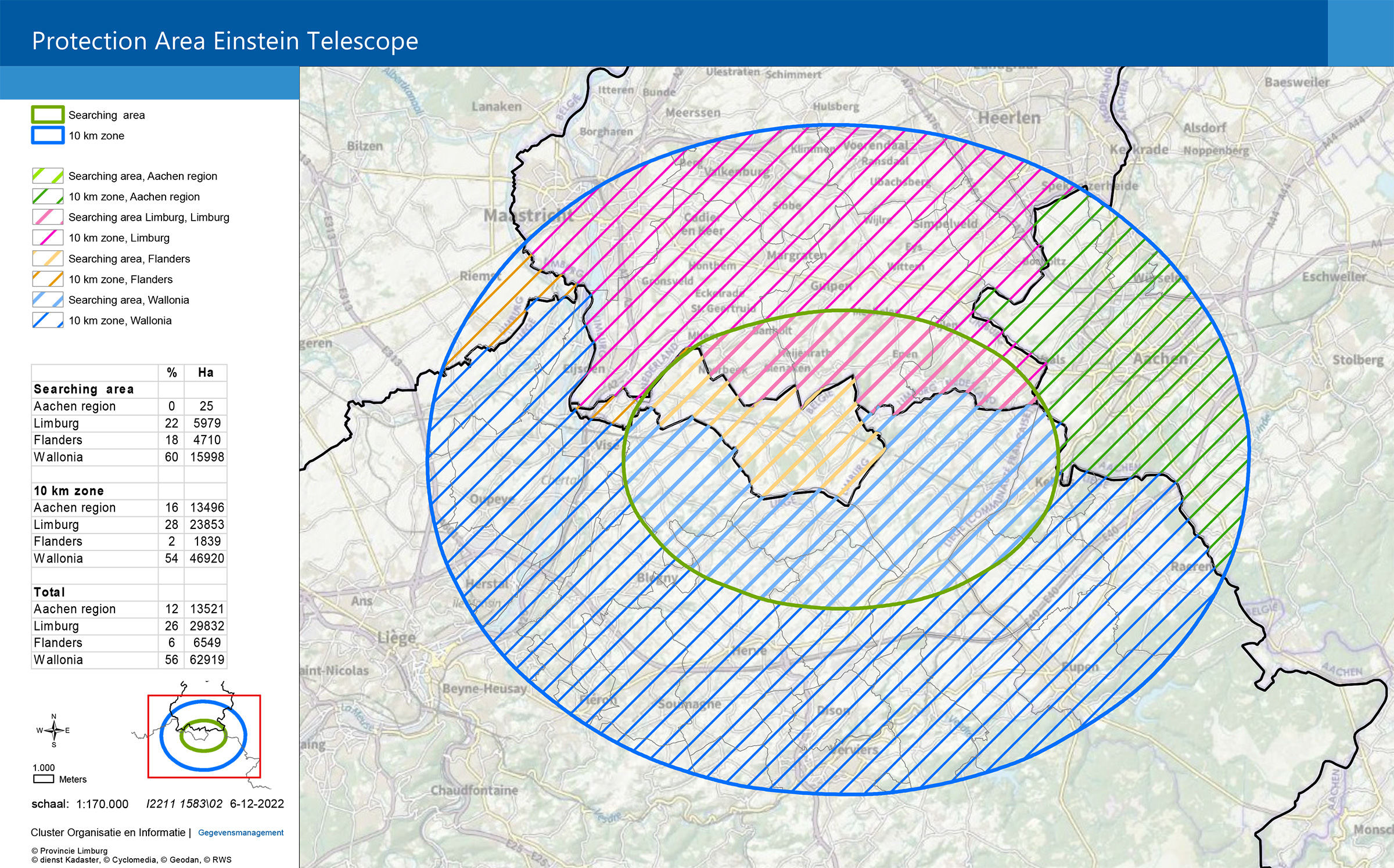
ET Protection Area
ET Design

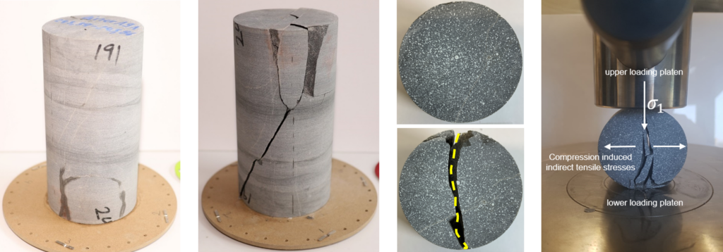
Subsurface buildings are significant and complex engineering feats. To plan the potential drilling operations of tunnel boring machines and the potential construction of tunnels and caverns, scientists are conducting tests on rock samples in both, the laboratory and in-situ (in its original position). These tests include, but are not limited to, seismic velocity measurements, shear, and tensile strength, and abrasivity tests. Rock samples are collected from outcrops and out of cores, drilled in Cottessen and Banholt.
Geological modelling
Data acquisition
There is an old miners’ saying “Vor der Hacke ist es duster” (Translation: “The way ahead looks black”), which describes the challenges of geologists perfectly when we try to predict the build-up and structure of the subsurface. We can only tell for sure what the underground looks like when it is laid bare, e.g. by drilling into it. However, the geology could change drastically only centimetres away from the walls of the borehole. To reduce this uncertainty, we combine geophysical exploration methods and observations from the surface. The gathered information is then integrated into 3D structural models, which try to predict the depth of geological units in the Euregio Meuse-Rhine. In the following, we will introduce the different methods used in data acquisition.

- Review of existing data (e.g. Maps, boreholes)
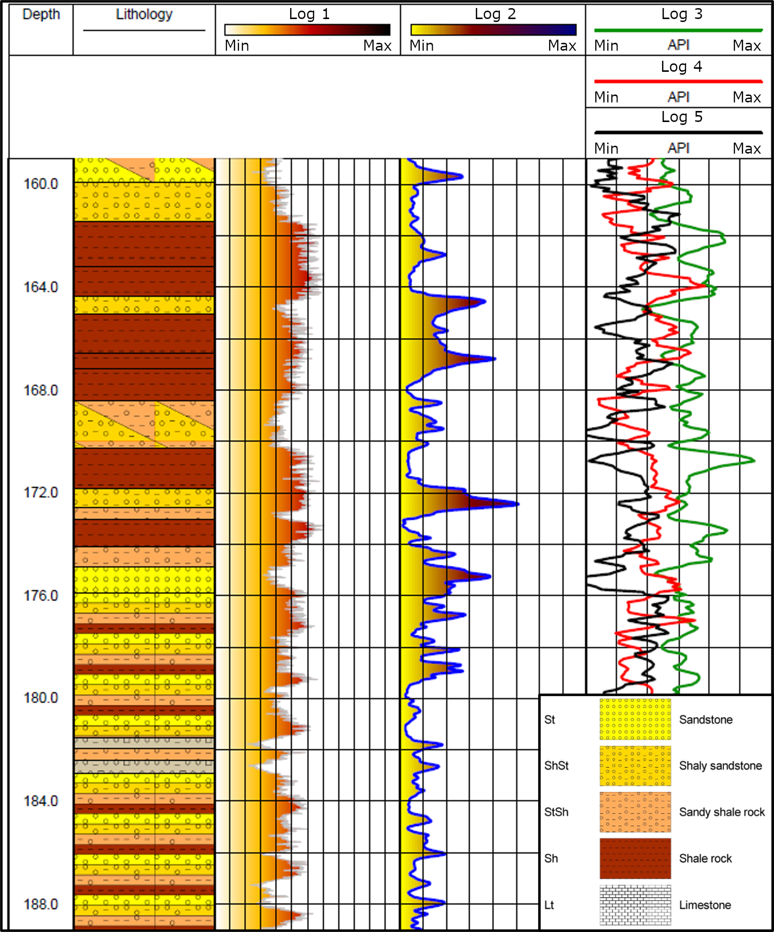
- Borehole logging and cores
- Active Seismic survey (https://gpg.geosci.xyz/content/seismic/index.html)
- Passive Seismic survey
- Electrical Resistivity Tomography (ERT) (https://gpg.geosci.xyz/content/DC_resistivity/index.html)
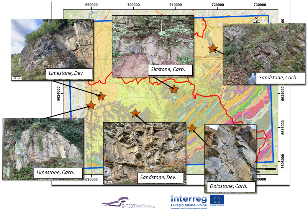
- Outcrop observations
- Others
- Airborne Electrical Magnetics (https://gpg.geosci.xyz/content/electromagnetics/electromagnetic_introduction.html)
Modelling

The previously mentioned exploration methods produce valuable insights. However, the shape, resolution, and accuracy of the data gained can vary a lot. Our boreholes drilled return insight into a very small area with high resolution, while the seismic campaign covers a much larger area at a much lower resolution with less accuracy. To determine the geometry of the target rock types for tunnelling and the position of key elements, such as faults, our geologists build 3D structural models. Different data input is combined, to a comprehensive 3D model, using the open-source modeling software Gempy, thus making the results reproducible for everyone, when the underground exploration concludes (https://www.gempy.org/). In addition to these 3D structural models, geologists analyze the accuracy of model input and investigate all solutions in the scope of the given uncertainty. These uncertainty models reinforce the decision-making process and further exploration (Photo).

Hydrogeological model
Advanced studies of the underground in the EMR region leading to an open geo-model and an in-situ observatory.
Groundwater plays an important role for underground civil engineering works. Groundwater conditions during the construction phase and during the exploitation phase must be anticipated in order to organize potentially needed drainage and pumping. The underground infrastructure can also have an impact on its surrounding causing a drawdown of the groundwater levels. This drawdown can impact production wells, feeding of the surface water or cause a subsidence of the area.
To evaluate the amount of groundwater to pump and the impact of this drainage, a 3D regional groundwater flow of the Euregio Meuse-Rhine is developed which covers an area of 1100 km² to a depth of -500 m to set realistic boundary conditions. The boundaries on the West, South and South-East are are defined by the Meuse River, the Vesdre River, and the base of the Famennian which outcrop from Nessonvaux to Gressenich. The boundary conditions at the North and the East are based on historical piezometric levels and are chosen sufficiently far from the test site to ensure a low influence on the simulated groundwater flow.
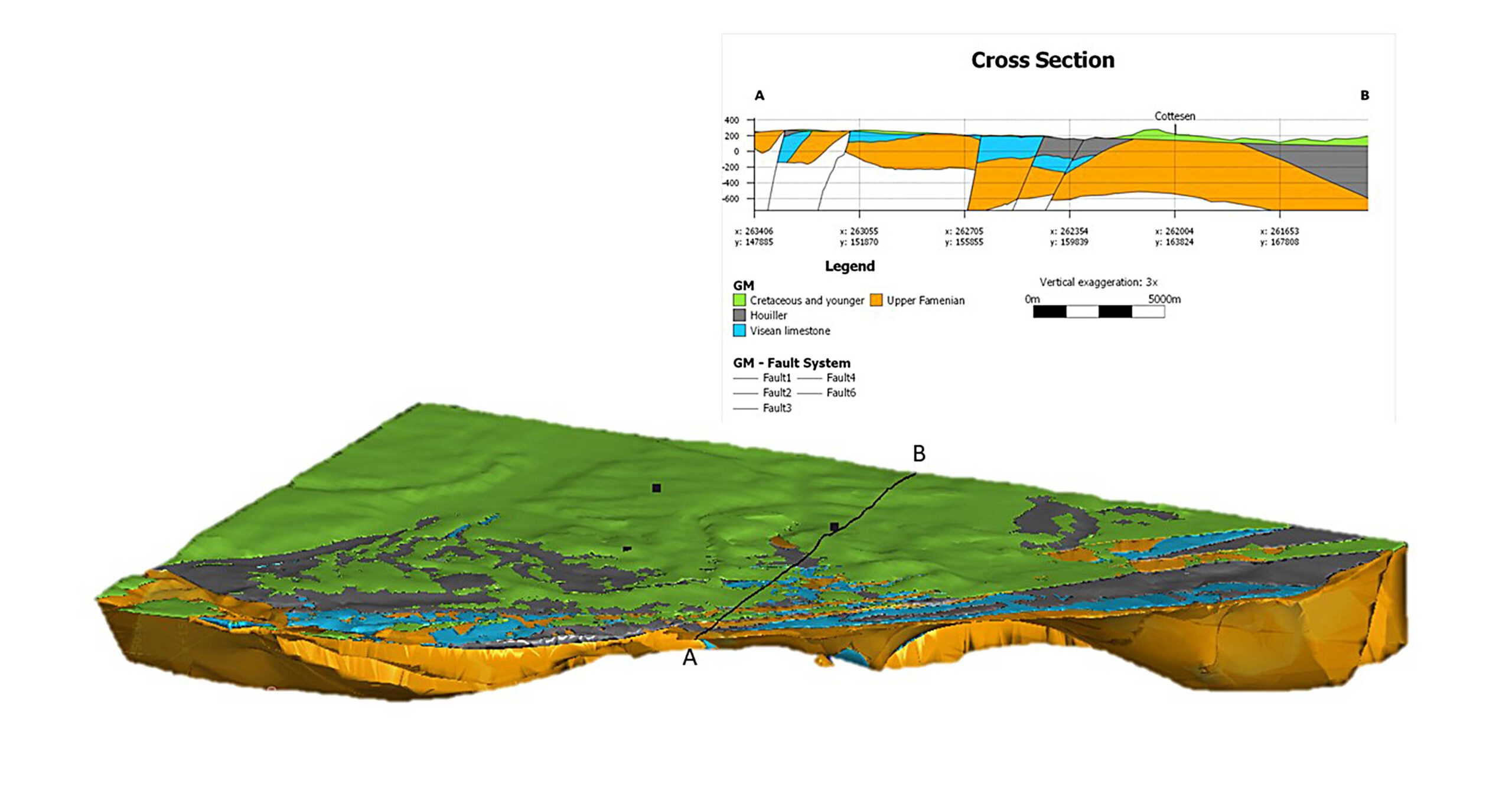
View of the simplified geological model of the EMR region used to create the hydrogeological model. It models 4 geological layers and 5 faults. The Cross section (A-B line on the model) is passing by Cottessen.
View the drilling sites